Friday, May 29, 2015

More Solar

May 17 – 19 -- I’m working a boondoggle right now. Our son decided he wanted a solar installation for his trailer, so I offered to help. We had some long chats and decided they would be best served by a portable panel since some of their favorite spots are shaded and the sun angle is always low enough that panels need to be tilted to be efficient.

Like most current trailers, their unit came without ANY 12 volt outlets. For someone using state parks or boondocking, 110 volt outlets are a waste of time and energy, so we started the project by installing three 12 volts outlets. While I’ll gladly admit to being a molded fiberglass aficionado, it was sure easy to mount new wires in a stick-built rig!


This project has been several months in the planning which gave Jeff time to get all the bits and pieces ordered. We used #8 zip cord cabling from PowerWerx and Anderson Powerpole connectors for the feed from the panel.


The pass-through in the front of the trailer provided all the access we needed for running the cables to and from the controller. We picked up the positive feed to the battery at the battery cutoff switch,

and ran the other three cables down and through the floor in the corner.

After long discussions about the pros & cons of various controllers, he decided to go with the Renogy Solar30 based on its adjustable charge point and the “good enough” theory. This one does a great job of showing what the panel produces, and tracks battery voltage, but it is NOT a battery monitor like the much more expensive TriMetric which I still covet.

 One of the Anderson connectors was bolted to the trailer frame at the front street-side corner, providing a point for connecting the extension cable from the panel. It is protected by a mud guard when not in use.

I’m not a fan of portable systems because it seems that storage for them is often an issue. In this case, the panel slides into a simple mount in the top of the pass-through. Simple, easy, and out of the way.

The installation was easier than I’d anticipated. We were done early enough that we took the family out to Eklutna Lake, one of three campgrounds in the very large Chugach State Park, for initial testing. This campground is pretty much a worse-case example for solar testing with lots of tall trees to shade the panel.


With an initial positive test, we headed to the Kenai for 10 days of extended testing.

Wednesday, May 27, 2015

Gambling

One of the advantages of my loving wife having conceived and borne an airline pilot (I was involved but she did the hard work) is the opportunity to play Non-Rev Roulette. Actually, now that I've retired, it's actually sort of fun and a good excuse for people watching at the airport if you guess wrong. With less than 48 hours to go, the numbers were looking pretty good, especially for the first leg.

Last year the Alaska contingent bought a new travel trailer and now it needs a solar installation. Most of the "stuff" was shipped direct, but every time I walked through the shop I added a bit more little "stuff" to the "just in case" pile. I guess we'll know if we remembered every thing after we get the installation finished.

After I got home from the Utah trip, we added a second hotspot to our arsenal. The new one is a 5 gig plan on AT&T, intended to be a backup when I'm in one place and BJ's in another. I'm going to gamble and take the AT&T unit. When we spent the summer in Alaska in 2013, Verizon didn't have very good coverage.

I rarely check bags, but I could see this one raising eyebrows at security so we'll gamble on checking a bag. Hopefully we'll get there the same time it does.

This is fun. A day or two to install solar and some 12 volt outlets and then 10 days or so of "testing" it on the Kenai Peninsula. Maybe even some Halibut fishing.

Monday, May 25, 2015

River Time

Week of May 3rd - One of the few advantages of being in the Phoenix area during the summer is that the Lower Salt River is flowing below Stewart Mountain Dam. With minimal water in the reservoirs this year, they waited until April 30th to turn on the tap, and so far the flows have been minimal.

We actually went to the river twice - the first time Kathy joined us but we'd decided early on that the river was too low for wood boats so she used our first kayak - a Swifty that has served us well for 16 years.

We started out the first trip with a calm wind and great reflections. Kathy & I couldn't decide if we liked the real Saguaro, or the reflected version.

The Saguaro were starting to bloom.
We had some typical birds. The vultures are usually around

as are the Great Blue Heron. We actually saw lots of other birds as well, and on our second trip when our friend, Helen, was able to join us, we she was able to identify them. Vermilion Flycatchers, Neotropic Cormorants, Cardinals, Red-winged Blackbirds, and several Bald Eagles to name a few.
We saw four-legged animals including several groups of wild horses

and a turtle sunning himself on a log. I was surprised by what I think was a young River Otter, but he/she/it was just as surprised and quickly dove again.

As usual, Kathy did a wonderful job watching for wildlife in the brush

while BJ kept her eyes open for "river booty." On the first trip, she found a nearly new squirter. I managed to "forget" to load it with the rest of the gear for our second trip.

The second trip was middle of the week. We started out with just our four boats on the water. This time, Candy was paddling the Swifty,

and Helen joined us. Years ago, we paddled with Helen multiple times a week but that changed when she bought her business in Bullhead City. This was the first time in 12 years that she'd been able to return to the Lower Salt.

Below the bridge we passed a group that were just launching. At least they got the message that no two boats in a group should be the same color!

The flows were absolutely the minimum that was floatable, especially for the upper section. Lots of rock scraping, but worth it for time on the river. It was especially nice to be on the river before tubing season when the trash increases and the animal sightings decrease.

By the time we got to the lower portion on the second trip, BJ and Candy were getting the relaxation thing down.

We've missed the Lower Salt the last couple years, leaving town for the summer. I suspect we'll be on the river some more, in between trips to cool off.

Saturday, May 23, 2015

Hope!

April 28 - I left Snow Canyon State Park in Utah, with nothing specific in mind. Had a chance to check in with river friends in Boulder City, Nevada and Bullhead City, Arizona and moochdocked at Tony's in Bullhead City. I hadn't seen him since we came off the Grand Canyon trip last year.

I took the back roads home, in part because I haven't been there in a while. In fact, the last time we passed through Hope, we were on our first day of our Alaska road trip. This time I got a picture of the sign coming into town.

Sixteen nights on the road. Eight nights boondocking, one night moochdocking, six nights in state or federal campgrounds including one free one, and one night in a commercial RV park. Camping fees averaged $5.53 per night.

I towed the trailer 1,560 miles and drove the truck another 405 miles, much of that on gravel roads. The overall fuel mileage for the trip was 16.5 mpg which I figured was pretty good considering I was over 9000 ft. elevation several times. I had lots of fun checking out some pretty incredible areas, and bypassed others that were clearly deserving of time and attention. I don't know when but I'm hoping to be back to spend more time in an incredible area not so terribly far from home.

I'm not sure what's next for the Scamp, but hoping we use it to keep cool in the high country this summer.

Thursday, May 21, 2015

Last of the ‘Glyphs

April 26 -- I stopped at Snow Canyon in part because I didn’t have a Plan D boondock selected and I didn’t really want to head for one of the Lake Mead options. The other reason was that I thought I’d seen a petroglyph picture associated with Snow Canyon.

Turns out, there are a couple ‘glyphs at one of the campsites, but that site was occupied. The super nice gal at the desk pointed me to the Anasazi Valley trailhead between the communities of Ivins and Kayenta. It’s an area within the Santa Clara River Reserve and has a bunch of petroglyphs. It’s supposed to be 2.5 miles r/t but didn’t seem like it.

Not only were the designs different, but the position of the petroglyphs was different as well. Many of these were done on the top of the rock, exposed to the elements. Even with that, and a large number of people visiting each day, they remain in amazing shape.

Instead of rock art on a large cliff panel, these were all on boulders and broken blocks of rock.

Those that were on the vertical or near vertical face of the rocks were all within arm’s reach.

This was the only group I spotted that were large animals. The two big ones were perhaps 2 feet high, each.


Part of what intrigues me about rock art is that no one can be positive about what it means, but several sources suggest the spiral pattern is a sign to tell others that the migration continues. With that, I’m not anticipating any more petroglyphs on this trip while my migration continues home. 

Tuesday, May 19, 2015

Which Way Next?

April 24 & 25 – I holed up in a great boondock location just south of the Mt. Carmel junction for a couple days to let some rain storms pass by while I caught up on a commitment I made to review some aviation software possibilities. I thought I’d have lots of time to do that on this trip, but I’ve been too busy hiking and gawking and blogging to get as much done on the software reviews as I’d expected.

This location has served me well in another regard. It’s close enough to Kanab to facilitate entering the Wave Lottery for Monday.

You need to be at the office at 8:30 to fill out the application for the walk-in lottery. By 8:15, people were starting to stand around, both outside and inside. They issue 10 spaces based on signups 4 months in advance, and 10 more spaces through the walk-in lottery the day prior to the actual permit.

At 8:30 we were herded ushered into a special room to fill out the application paperwork. There were people there from Russia, Sweden, Germany, Japan, China, Israel, Canada, and quite a few states, all hoping to get a coveted permit for the 6 mile hike.

At 9 a.m. MDT they started calling the magic numbers. There were 46 applications representing 87 slots (one application per party). The first five numbers chosen had two people in each group. Party over!

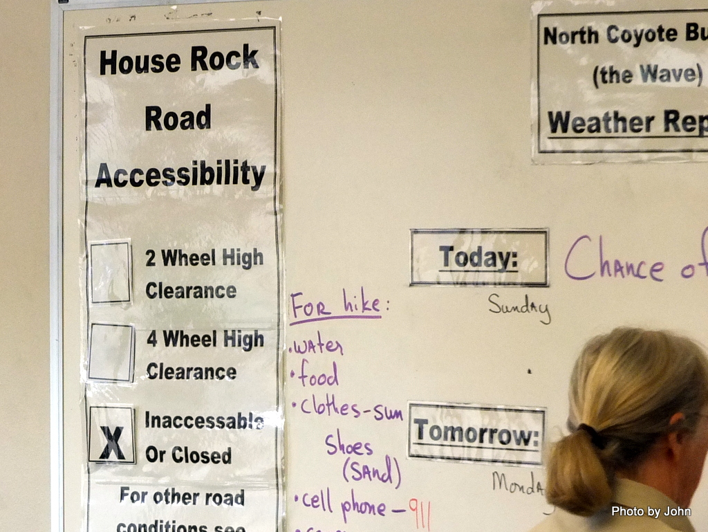
Meanwhile, another piece of information was on the whiteboard. While it might clear up for tomorrow, even 4WD vehicles were struggling with the road because of two days of rain. The road was closed which meant another possible hike in the area was also off the option list.

With that, instead of east, I headed west with Zion as my next proposed destination. Seemed like a good idea to me… I picked up a couple hitch-hiking hikers at the junction and took them back to their car at the east entrance and then headed through the tunnel. With no traffic behind me, I was able to grab a quick shot out the window of the tunnel.

As always, Zion was beautiful,

but by now it was past noon, and both campground were full. The Zion shuttle buses were now running, and every place in the park and in town was parked full. Didn’t look too interesting to me, and the one boondock I considered had a muddy road.


Home for the night ended up being the campground at Snow Canyon State Park in St. George, Utah. Beautiful red rock, lower elevation, and lots of wind. 

Sunday, May 17, 2015

Wall Street Crashed!


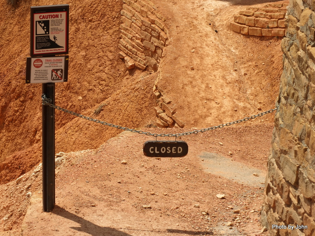
April 23 – Wall Street is possibly one of the best known features below the rim at Bryce Canyon National Park. Unfortunately, it crashed – or at least a portion of it did – closing that section of trail.

Instead, I headed over to Sunrise Point to pick up the Queen Garden Trail. A very well-maintained trail, I might add. Without a doubt, the nicest trail I’ve been on in – maybe forever.

It’s not a solitary experience. Maybe that’s because the very nice Map & Hiking Guide they hand you at the park entrance says in bold text, “If you’re lazy enough to do just one If you can do only one, the Queens / Navajo Combination Loop might be the best one.” 2.9 miles with 600 feet elevation change.

As soon as you drop below the rim, the views improve. The clouds and high 50’s temps made the Pendleton feel good, at least for the first two miles, the vast majority of which was downhill.

The upper portion of the trail had multiple portals cut in the fins. As always, click on any photo for a larger version.


The double bridge was in a little side canyon.

The Guide had recommended this route be done in a clockwise direction, apparently to save the best for last. The squiggle portion on the map was amazingly well-built,

but, looked much better from the top of the switchbacks.

Unfortunately, just because the stacked switchbacks were over, it didn’t mean the trail was finished,

but it did make a nice spot to appreciate the view for a moment.


With the Wall Street section closed, the loop actually measured 2.7 miles. The Guide said 2-3 hours, but I was done in 1:40 including stopping for 95 pictures. It was a wonderful hike and I'm really glad I didn't it in the summer.