Friday, June 28, 2019

Here, Fishy!

The Russian River, at and above its confluence with the Kenai River is known around the world for its salmon runs. It's a favorite place to fish for our son and his family & friends. This year, the first run reds (sockeye) have exceeded all expectations.

While our daughter-in-law went with us to get our rigs settled in to a primo site at Kelly Lake, our son, grandson, and his friend stopped off at the Russian to see why the limit had been upped from three to six fish. Five hours later they were hauling 18 headed & gutted fish back up the hill from the river.

Everyone seems to have their favorite spot. The confluence of the Russian with the Kenai is often crowded. I expected to see more people given the run reports but it was mid-week. If you look carefully (as always, a larger version is available if you click on the picture) there's a lineup fishing the Kenai downstream from the confluence.

Fishing in Alaska is a family affair and they start them young!

I took this picture to document the only four legged wildlife I saw, but then spotted a black bear for a couple minutes, well up river from where our folks were fishing.

It took away, but I finally spotted a wild rose that was still a bud.
Meanwhile, our son (in the yellow shirt) was teaching BJ a bit about river fishing. I believe it's the first time in over 47 years that she's had a fishing pole in her hand.

While our grandson and his friend were limiting, Jeff and BJ were having fun.

Between them, they accounted for three fish.

There are several access points along the lower Russian, all with stairs (and fences) to protect the river banks from erosion.

Another day, another bunch of fresh red salmon headed to the freezer - all except one that didn't get that far - the grill won out.

The next day, the grandson went back with his friend and the friend's father and grandmother. The limit had been raised again, this time to 9 fish. It was a long day that resulted in a couple tired boys, but there were 30 salmon on the stringer when they quit that day.

While the season continues, fishing is done for our Alaska contingent with more than enough to keep them in salmon for the year.

Monday, June 24, 2019

Geocaching Alaska

Back in April, I picked up a Travel Bug (TB) that wanted to travel to Alaska. We took it with us to a couple Arizona caches before we left on our trip, and then documented some of the places we visited with pictures added to the TB's gallery page.

Since the TB's owner wasn't specific as to where they wanted it to go in Alaska, we dropped it at a place with an appropriately Alaskan name. Mosquito Fork is host to the Chicken Scratch Cache (and a lot of mosquitos!) and is located just south of Chicken, Alaska.

In mid April, Geocaching Headquarters announced a promotion in partnership with the Forest Service and others to celebrate Smokey Bear's 75th Birthday. I was one of the 1,500 applicants that were drawn to receive a trackable which arrived in the mail just a couple days before we left home.

We brought our Smokey trackable with us on the drive north and then found an appropriate cache (Alaska the Beautiful) to drop it in north of the Wrangell - Saint Elias National Park. The cache certainly seemed appropriately named. This trackable was picked up a week later and has continued active traveling around Alaska.

Once we got settled with our moochdocking arrangement at Jeff & Carleta's neighbors, I got a chance to go out geocaching Alaska style for an afternoon. We'd hoped to go for a series of T5 caches, but the river was the highest they'd ever seen it - too high for the wheelers. Instead we did a nice short set of ammo can caches.

We haven't done a lot of geocaching since we arrived in Alaska, but I have been impressed with the quality of many of them. This one was located near a campground, and needed a magnet to open it.
Even once it was open, it took some inspection to locate the log container.

The state has an active geocaching organization. This is the first container with their logo that I've found this trip, but I found several of them when I was in Alaska in October.

We're having a great time with family who are enjoying the excellent Red (Sockeye) Salmon run. More on that later.

Thursday, June 20, 2019

Don't Be Chicken

All too many people say don't be stupid when talking about driving the Top of the World route between Dawson City, Yukon & Chicken, Alaska. My response is don't be chicken! Since the border is closed during the winter, the first step to this route (westbound) is the free seasonal George Black ferry to cross the Yukon River. We missed out six years ago because the river thawed later than normal

I checked the weather report a couple days prior and it was calling for low 70's and sun. We did start out the day with some bright spots but very little true blue sky. At least it was clear enough to understand where the "Top of the World" name comes from.

The vast majority (all but a couple miles) from Dawson to the border (67 miles) was wide, excellent gravel. I didn't drive the posted speed limit (50 mph equivalent) but was very comfortable driving at 40 to 45 mph on this section. The views were beautiful and the road was excellent. We had occasional sprinkles, just enough to hold the dust down.

The Canadian and US border post was visible when we came around a corner.

Customs questions were of the typical firearms, alcohol, fresh fruit variety. Less than five minutes and we were on our way. The more interesting part of the border crossing was the cabin across the road from the sentry station. Not clear if it was a part of the customs complex or not.

The gravel road from the border to Jack Wade intersection (three way Chicken/Eagle/Border) was narrower than on the Canadian side. It was nice to not have much traffic for this 17 mile section so that we could pick and  choose our line to avoid the vast majority of the potholes.

It rained, sometimes heavily, most of the way from the border to Chicken. The last 22 miles from Jack Wade to Chicken was the narrowest and had the biggest potholes. Much of this section was driven at 25 mph because of the rain, potholes, and oncoming traffic.

We stopped for a few pictures in Chicken. Obviously, a picture of  "the" chicken was necessary,

but the real reason I stopped here was because I wanted to see the Pedro dredge, still parked where they quit using it.

We'd heard about Susan's chicken pot pie and couldn't resist since it was now approaching 1:30 in the afternoon.

The tour bus that had passed us was finishing up so we didn't have any problem getting a seat. I did, obviously, forget about getting a picture until it was about 75% gone. Huge serving, excellent food, but NOT cheap!

Turk and BJ had to check out the Chicken sled photo opportunity.

My advice - don't try the road unless you're planning to wash your rig, but even in the rain I thought this was a "don't miss it" experience!

In my opinion, the 67 miles of asphalt from Chicken to Tetlin Junction was MUCH worse to drive. Yes it was asphalt, yes it had fewer potholes, but the frost heaves were MUCH worse (although not as bad as the yet to be experienced Tok - Glennallen section!) In my opinion, the gravel is NOT a reason to skip Chicken!

Sunday, June 16, 2019

Tale of Two Dawsons

Dawson Creek is near the northeast corner of British Columbia. It's famous as the Mile 0 point of the Alaska Highway. It's the center of an area of an agricultural economy. As you travel west on the Alaska Highway, you'll experience an area with a petroleum economy before getting into the Rocky Mountains, known for their beauty and potential for animal sightings.

If you travel far enough west, you'll eventually run across this sign the second time you enter the Yukon territory. The sign at the first crossing from B.C. to Yukon has seen better days, but the second crossing is clearly marked, perhaps because it's on the outskirts of Watson Lake.

Whitehorse is the capital of Yukon and home to about 75% of the territory's population of 38,000 people. Whitehorse is a juxtaposition of government, supply center, and history. There are lots of interesting things to see around the area, but this trip we were headed north.

We overnighted at Five Fingers Rapid, a point of concern for river travelers headed to the Yukon gold rush. The recreation area parking lot had no limitation signs although their website says it's day use only. Just beyond Five Fingers is the Tatchun Creek Campground, a typical Yukon Government Campground with free firewood, outhouses, and gravel sites for $12 a night.

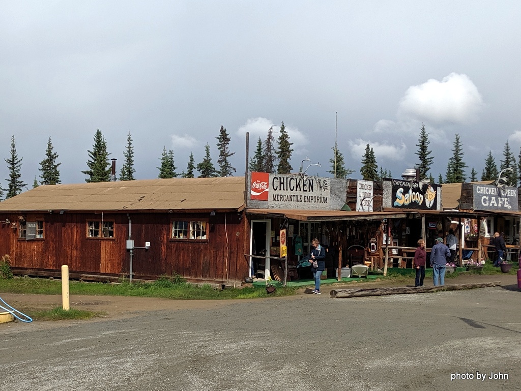
Dawson City was high on my list for this trip. We missed it last time because the river hadn't thawed yet. As a fan of history and rust, I was in my element.

Dawson City is the second largest city in Yukon, with a population of about 1,800 people. Mining is still active in the area.

The town is an interesting mix of old buildings settling into the permafrost, old buildings restored and used, and new homes and businesses, some made to look old.

Saint Andrews was built in 1901 and last used in the 1930s. The building is now internally braced but continues to settle.

There was an earth cache concerning permafrost that led us to look carefully for buildings that were settling. This was my favorite, but I couldn't ever get a picture without something parked in front of it.

Across the river, past a very nice (and large) Yukon Government Campground, was the paddle wheeler graveyard. There were six wooden hulled paddle wheeler sitting along the river, mouldering into the sand as the forest grew through them.

One one of the six still had recognizable paddle wheel frames. Of course, it also hosted a geocache!

Fans of Discovery's Gold Rush know that dredges are still in use in the area. The largest dredge is not in use but is in the continued process of restoration. It was so large I couldn't get a decent camera angle to get it all.

The dredge buckets for Dredge #4 were large enough to make a lounger.
As we wandered, we would find old equipment. In this case, a Caterpillar R-4 with a cable operated blade. Originally used to build the Alaska Highway, it then found a life on a gold claim.

Abandoned trackhoe hiding in the trees.

My favorite was this very creative trommel, supported by old truck wheels & tires, and powered by an old truck rear axle. Since it was parked with a bunch of other old, tired equipment, it's hard to say if it was ever successful.

We didn't seen Tony or Rick or Parker as we wandered around town, but I did spot the Jasmine B and Kid Commando (which looked scary skinny) parked next to the ferry landing.