April 19 -- I left my
Comb Wash boondock location, heading west, stopping at Natural Bridges National Monument. Even though it was very few
miles, I thought I might stay there and do some hiking, but their 13 space
campground is limited to 26’ total length, and in a quick drive through, it was
clear that my 30’ overall wasn’t going to fit! Plan B called for more miles and
less hiking.
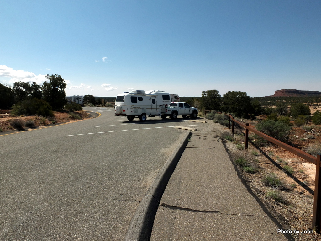
The loop road, aka Bridge View Drive, is a very nice
one way road. I was comfortable pulling the trailer, but glad that it wasn’t
very busy. Very nearly all of the parking at the viewpoint trailheads is
angled. Some of the spaces at each location were deep enough for me, but an RV
with a toad would have a challenge. None of the spaces were marked except for
ADA, so the Cadillac driver
always parked in the longest space. Go figure…
The bridges were a bit challenging to photograph from
the viewpoints since the tops of the bridges would blend into the canyon walls
in the background. The NPS says that Sipapu Bridge is the second largest
natural bridge in the world, exceeded only by Rainbow Bridge in Glen Canyon.
The same bridge from the trailhead to hike down to
the creek below the bridge. “A staircase and three wooden ladders aid in the
descent.” Apparently early visitors to Natural Bridges climbed down a tree to
access the bottom of this bridge.
There are ruins and pictographs in the canyons
between the bridges. The Horsecollar Ruin can be viewed from the rim at a
dedicated viewpoint. The ruins span from the left edge to nearly the right edge
of this photo. (As always, you can click to enlarge.)
The ruin is named for the horsecollar shaped doorways
in the granaries at the right hand side of the alcove as you face it.
There is another alcove with a very nice set of
structures viewable from the same point.
The Kachina Bridge is considered the youngest of the
three bridges because of the thickness of the span. The trail to the base of
this bridge lacks wooden ladders. There is a trail in the bottom of the canyon
that links the bridges together.
The third bridge on the loop is the Owachomo Bridge.
It has the thinnest span and hides in the background.
The trail to the base of this bridge is the shortest
at ¼ mile each way and only 180’ elevation drop.
Someone had done a lot of work cutting and fitting
stone steps for much of the Owachomo trail.
While the park wouldn’t be too comfortable for rigs pulling
a toad, longer trailers, or beast-sized RVs, there are a couple places near the
park where larger rigs can camp or park. One is east of the park entrance about
¼ mile southeast from the intersection of Highway 95 and 261 where
rigs congregate around the corral. The other is south of the park on 95
between mileposts 87 and 88. It’s a long piece of old road alignment with two or three
separate entrance driveways and room for dozens of rigs.
If natural bridges weren’t enough, I couldn’t resist
adding a picture of the bridge over the Colorado River (since the lake is very
low) at Hite.
Home for a couple nights was a
large parking lot with a couple outhouses just west of the intersection of Temple Mountain Road and
Goblin State Park road. There were at least 8 of us there, nicely spread out,
watching the storm clouds build.
This post was uploaded and scheduled using wifi at my site at
Sand Creek RV Park in Torrey, Utah.


If I'm not mistaken, we were at Natural Bridges a year ago today. You sure have the memories boiling over.
ReplyDeleteAnd good memories they are, I presume. I'm certainly looking forward to going back.
Delete