The
online description that I read about this hike wasn't real specific -- "The trail starts near a mesquite tree..." Turns out public parking is not available at Saguaro Lake Ranch because of limitations of their license with the Forest Service. Park at Water Users and walk upstream to the Ranch and then chose which mesquite tree you want to use as your starting point.
The trail is unofficial, and used primarily by horses from the ranch. It is very well worn in most areas and not hard to follow. The trail climbs up the hill and provides several view points of Saguaro Lake impounded behind the Stewart Mountain Dam.
For an unofficial trail, it is well signed, at least in a couple places. There's another sign like this near where the 3+ mile loop crosses the Bush Highway, but it faces the other direction and says the trail ends in 1000 feet.
This sign, located above the dam, seemed pretty clear to me.
Along the way there were great views of Four Peaks (it was a mountain before it was a brewery!) and the Goldfield Mountains. We were surprised that there wasn't any snow on the top of Four Peaks given the recent weather forecasts.
The trail passes through wonderful, undisturbed Sonoran desert with lots of Saguaro and other cacti.
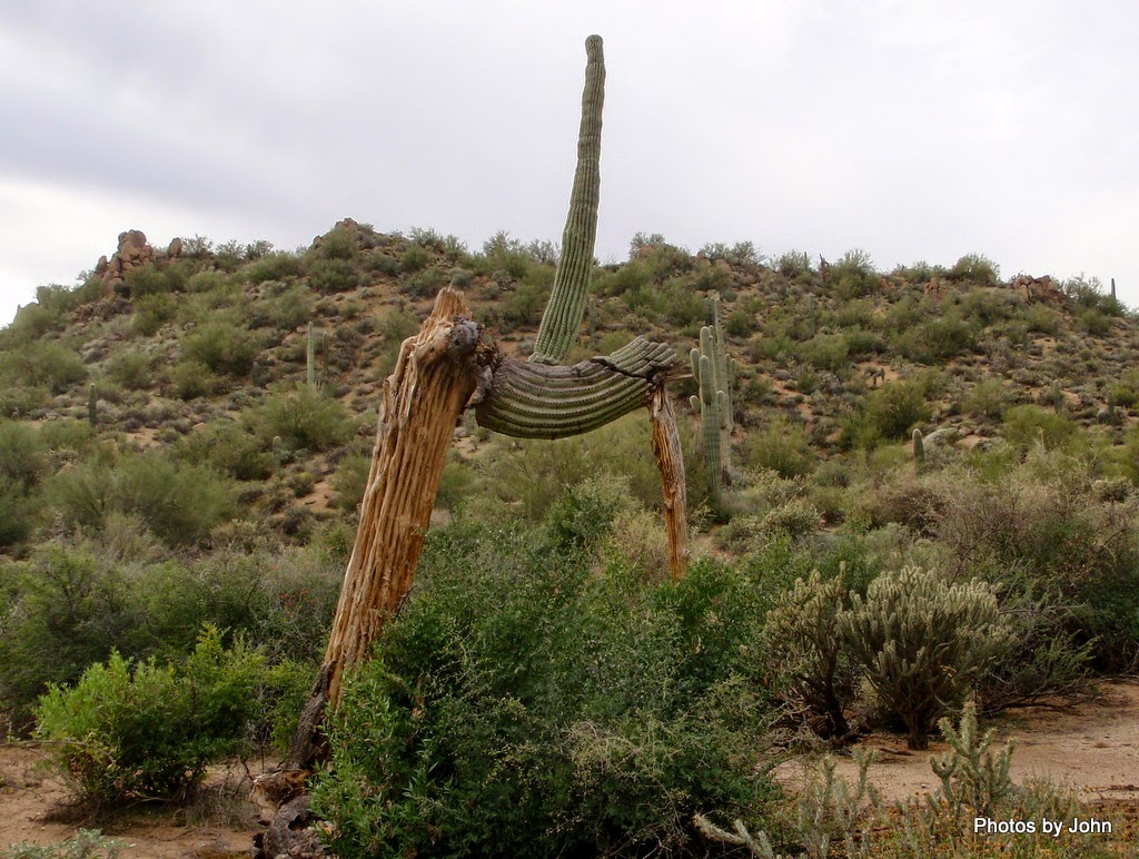
This one was unusual. The lower section was long dead while the upper section, though once broken, was still robust.
Large examples of Saguaro stand in the background with dead remains of others in front of the Palo Verde trees.
We decided this one was the Disney cactus with all the twists and turns of a good roller coaster. This was my view
and this was BJ's view.
I was very impressed with the country the hike wandered through with things catching my eye all along the way. In addition to horse prints (and some used feed,) we spotted sign of coyote, deer, and javalina.
This trail drops into Horse Thief Wash, the same wash that forms the back side of the Goldfield Oven loop. The wash was a worthy destination with the largest grove of mature ironwood trees that I've ever seen, some with trunks up to 24 inches in diameter.
There is a pair of very large culverts that direct the wash under the Bush Highway. After passing through the culverts you'll reach the old highway alignment. A right turn will take you to Water Users river access point (daily pass required but NOT available at the parking lot $3/$6) while a left turn will take you to the ranch.
Most of the time during this hike you can see portions of the Goldfield Mountains on the far side of the Salt River. With a lot of overcast, pictures didn't do these mountains justice.
And yes, there were some petroglyphs on this hike, although I didn't thing the small collection was the highlight of the trip.
I'm a petroglyph fan, but for this hike, I was blown away by Horse Thief Wash and the desert on the west side of the highway. In my mind, that was the highlight of the hike.
If you're really interested in the petroglyphs, let me know and I'll give you better directions.


...that last photo is the most intricate rock art I've seen...really perfect!
ReplyDeleteThat one was by far the best of the bunch. Quite surprising for a boulder at ground level.
DeleteWe discovered the beauty of the Tonto National Forest on our first trip....camping at Tortilla Flatt before it was closed. Love your photos reminding me of the green desert. I am ready for some desert hiking!!
ReplyDeleteI'm really bummed about Tortilla Flat not opening again this year. There is a limited number of good boondocking spots further up the road - and a bunch that aren't so good in my opinion. The desert is looking really good this year thanks to multiple summer storms.
DeleteWe explored a few b. d. sites just past "town". Would love to know about more as we do enjoy that area. Not sure if the forest service will ever reopen it. Maybe a private contractor some day. RV Sue has been writing about Roosevelt Lake area going up in their fees. Do you know anything about increases?
ReplyDeleteI saw that mentioned on RV Sue's blog but haven't heard or seen anything else. Always been surprised that camping in Tonto is same cost as a daily pass. Wouldn't be surprised to see that go up and utilization go down. Looks like dry camping at the river access points is closed this year, at least at Blue Point.
Delete