Sunday, November 16, 2014

The Virgin River Narrows

November 12, 2014 - With all the teasers about hiking the Narrows, I just HAD to do it. The shuttles aren’t running during the week this month, but since all of the Zion Canyon parking lots are full by 10 a.m. or shortly thereafter, I headed out with the intent to start my hike about 8 a.m., ahead of the crowds. Lots of deer and a few nice turkeys to be seen.

Pictures were a challenge with the low light of early morning and my tired and limited Olympus (still waiting to get the Fujifilm X-S1 back.) That didn’t stop me for taking lots of pictures – I’ll just not bore you with most. Just turning the corner after leaving the end of the paved River Walk, I could see this was going to be a fun and worthwhile hike. And for the most part, my relatively early departure got me the solitude I was hoping.

The ‘trail’ usually just had one obvious choice but the ‘surface’ could be cobble, water, or occasionally sand. With the river flowing at 47 cfs, I was never in the 51 degree water deeper than the top of my knee caps, but you had to be observant. I spotted one person walking in water up to his waist – if he’d moved about 8 feet to his left it would have been ankle deep…

Almost everyone I saw were using rented dry pants, neoprene socks, and boots from Zion Outfitter or Zion Adventure Company. I was using my NRS farmer john wetsuit, wool socks, and my NRS neoprene work boots which proved to be a very good combination. Of course, I was the only person I saw properly outfitted with a Pendleton shirt. And now for some pictures… 
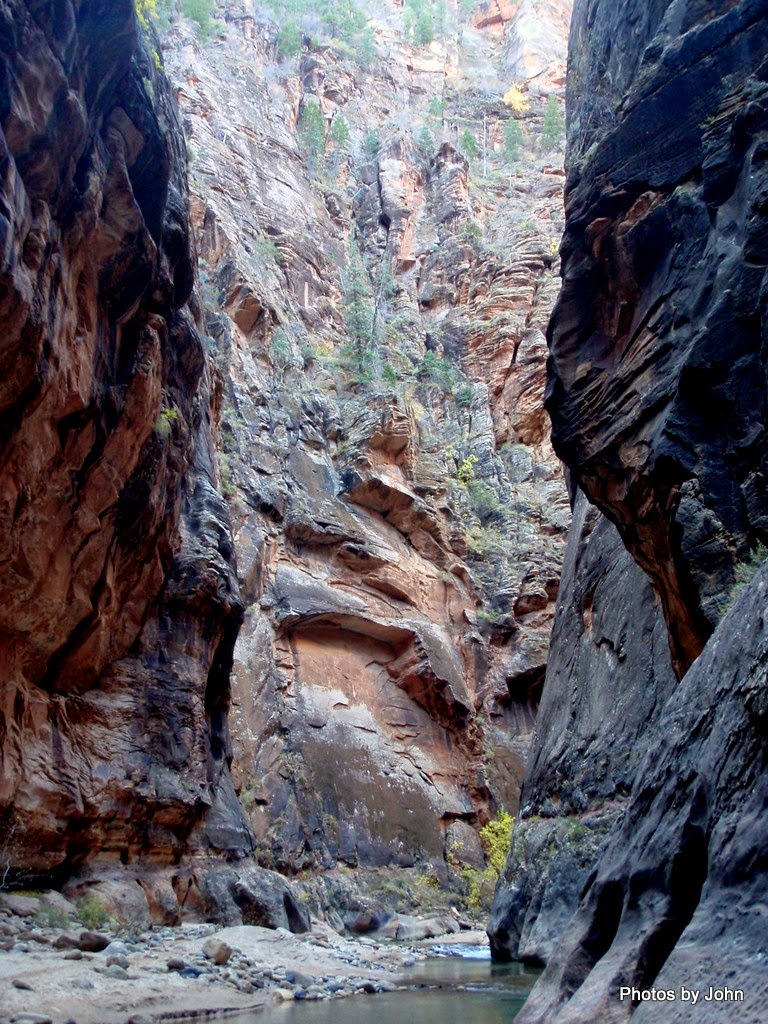

The pictures actually got better on my way back with more light in the canyon, but more people as well. Unfortunately, I used up most of the camera battery going upstream and didn’t take near as many coming downstream. I continued past Orderville Canyon, curious about what was around each corner. Looking at detailed maps later, I apparently stopped just short of where the canyon from Potato Hollow Spring intersects the Virgin River.

Going upstream I saw very few people. I had one barefoot person with shoes in his hand past me going up but I then passed him both directions as he stood at the same spot in the middle of the river taking pictures for over an hour. I also passed a group of three photographers near the mouth of Orderville Canyon. I saw lots of people headed upstream as I headed down (perhaps approaching 50 but I lost count) including a young couple from Nebraska celebrating their honeymoon. I took their picture for them, but never took one with my camera.


All told, a phenomenal day! About 7.5 miles total which will totally shock some of my friends, but it was delightfully cool and there was a river involved – perfect hiking situation!

Saturday, November 15, 2014

Arizona Strip

Squeak and I swung by the boat launch about 7:30 a.m. to see how far the water comes up the boat ramp as we were leaving Lees Ferry. Still less than 1/3 of the pre-dam flows during some of the summer floods. I understand why they limit it to 32,000 cfs. Much higher would cause problems with some of the current infrastructure. The post in the center of the picture is on the cable stretching across the beach that rafts tie off to when they’re rigging.

I stopped at the Dominguez & Escalante Expedition historic marker, in part because I haven’t stopped there before. They wandered through this part of the country 240 years ago! My target for the day was Zion National Park but there are significant grades between here and there.

I didn’t stop at Jacob’s Lake – the bakery with the famous cookies was open but the BLM campground was closed for the season. Usually, we’d hang a left there and head for the north rim, but today my target was Zion National Park. A stop for a few groceries and then McDonald’s free wifi to upload the past three blog posts and then it was on to Zion.

East of the tunnel there were all sorts of NPS rangers and SAR crew rigging up. Maybe it was practice, but I’m betting someone had a bad day. Speaking of tunnel, there is a $15 surcharge for vehicles over 7’10” wide (including mirrors) or over 11’4” high because they will require 1 lane traffic control through the tunnel. Sure is nice to be towing a Scamp!

The red rock and the changing leaves in the fall made for a nice contrast. As a desert dweller, we miss out on much of the falls colors.


I was able to get a spot in the Watchman campground for three nights without reservations. Sounds like they may be full for the weekend. I was surprised to get a spot in a National Park that had electrical service. $10 for seniors – not bad! And just around the loop from me are two bloggers that have been posting eye candy about the Moab area. Lynne and Suzanne’s posts about all the hiking they’re doing in Zion should start showing up one of these days. Meanwhile, Mark and Gayle’s posts about their visit to Zion are part of what attracted me here. 

BTW, Watchman is on recreation.gov and it sounds like reservations are essential for smart people. South Campground was first come - first served, but I didn't think it was as nice.

This was posted thanks to the free wifi at McDonalds in St. George, Utah.

Friday, November 14, 2014

Lonely Dell

Up a short road paralleling the Paria River is Lonely Dell. Built by Lee and later ferry operators and then expanded by ranchers, Lonely Dell was home for various families from the 1870’s until the mid 1900’s. (If the parking lot is full there’s no turn-around for trailers.)

There are several log cabins remaining

as well as a very nice dugout that appears to have been reconstructed recently.

The large house was built in 1935 when the area was known as the Weaver Ranch.

No ranch would be complete without a collection of rust.

Just west of the buildings and the rust, was a fenced cemetery.

These hand-carved headstones tell a part of the story: Lucy Emett, born & died, June 11, 190? and Calvin Marshall Johnson, born May 12, 1928, died December 14 the same year.

But the most poignant of all was this stone added later to supplement the four crude sandstone markers behind it – one family, four children, all who died within 45 days of one another in 1891. No wonder they called it Lonely Dell.

The trail continues for 45 miles beyond Lonely Dell through the Paria Canyon. It’s not a place to be in the summer heat or when there are storms brewing, but it was nice to see some water still flowing in the river from recent storms.

There are some minor remains of cattle operations, and since the portion up river from Lonely Dell is BLM (permit required for hiking), it’s likely that there are still cattle in the area.


The ground, even 10 feet above the current river level makes it clear that water is key to life in the Paria.

It's been interesting to visit Lees Ferry and then to start reading P.T. Riley's very well researched history,
"Lee's Ferry: From Mormon Crossing to National Park."