We found a camp spot within 1/2 mile of where the Miller Flat Road (FS0014) leaves Utah Highway 31 between Huntington and Cleveland Reservoirs. The gravel road south is very good, and we saw lots of large trailers and toy haulers along the way.
In spite of the country being well about 9,000 feet elevation, there are extensive wetlands, ponds, and reservoirs throughout the area.
Depending on the angle of the photo, Potters Pond was quite picturesque. Other angles showed how close last fall's forest fire came to the campground, burning right up to the edge of the pond.
The Potters Pond cache is only one of the caches in the area, but it's the one most sought because it is one of only three remaining caches that were placed in August, 2000.
We parked out of the way near campsites 18 and 19. These equestrian campsites are at the end of the road and there is no turn-around, so staying as far to one side as possible will help campers who need to turn around. This turn around is within a couple hundred feet of the Potters Pond 10 & 59 Year Birthday Bash cache which we used as a waypoint.
The first section of trail was very evident, passing through a meadow of wild flowers while paralleling the north side of a creek.
There's a large log across the creek downstream from where we crossed, but the creek was low enough that we decided to rock hop across the creek. Just across the creek is a letterbox hybrid cache, Potters 2 Present: Int'l Geocaching Day 2014! which became our second waypoint.
From the letterbox cache we headed south through a clearing where we saw some of the early signs of aspen windfalls that would become an integral part of the hike. The route through here was just a geotrail of bent grass but no bare tread. There were a couple barrels along the way that had clearly served as targets at some point.
There was a route that appeared to be an old overgrown logging road part of the way up the hill, with the route being very obvious until after we passed this larger windfall that was easier to go under instead of over.
From that point on, there seemed to be multiple routes, sometime with some bare tread, sometime with shorter vegetation. There were lots of windfall and sometimes it was easier to go around instead of over, but it was very clear that folks were finding lots of different ways to get there!
We'd been warned about the mosquitoes and had prepared accordingly so they weren't an issue as long as you kept moving. Once we got the cache open and started looking at the logbooks, the bugs started to descend so we didn't spent much time at the cache. We signed the log and
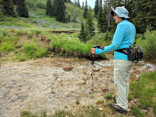
paused long enough to get a picture of me. I got a picture of BJ as well, but that picture gives away the location of the cache.
A huge thanks to BJ for putting up with the significant detour on the way home and for joining me for this cache.


No comments:
Post a Comment