Wednesday, August 30, 2017

Chillin

When we moved into our home in 2001 one of my first project was to install a swamp cooler in the garage. I was able to locate one that had the duct oriented vertically so that it fit between the wall studs. Wasn't cheap, but was an easier installation.

The pan has been rebuilt a couple times but last year was the end of life for it. This summer, since we returned to the valley earlier than usual, I decided it was time to replace the old swamp cooler with a thru-the-wall air conditioner. The swamp cooler was 110 volt and was on the same circuit with the rest of the garage.

When I went shopping for an air conditioner, I expressly wanted a 220 volt unit so that I could move the load to the circuit that was only carrying the table saw.

I thought about a 18,000 BTU unit but that wasn't going to allow me to run the AC and the table saw at the same time.

After getting the parts in stock, I got up my nerve and ripped out the old swamp cooler. Pretty sure the bottom was rotted out!

I couldn't put it off any longer. Time to start cutting out some drywall,
and frame up the new structure for the air conditioner sleeve.

I should have finished up the drywall patching before I installed the air conditioner, but I had to see if it would fit and if it would work. The answer to both questions was yes!

It struggles to cool the whole garage in 110+ degree heat but it does a great job keeping the area around the workbench very comfortable! I'm just chillin'

And yes, I did get the drywall finished - and some geocaches started.

Thursday, August 24, 2017

Sunrise

I've been out placing a few caches and finding a few other caches around the neighborhood, enjoying the sunrises and the views. It isn't often that we get a chance to get a sunrise reflection in a mud puddle. This was my view on the way to check out my Ponder cache.

Since it's monsoon season in Arizona, it's difficult to get a sunrise (or sunset) picture that isn't obscured by clouds. I'm learning that the clouds effects makes for some very interesting sunrises. This is the view from the logically named Lake View cache.

Occasionally, the sunrise looks like fire. This was my view when I place the How Many Kids?? cache.

On rare occasions, the sunrise is viewed over a sea of houses with lots of early mornings joggers about, although my preference is for the solitary peace of the desert. This was the view from the Arizona Jasmer Challenge cache.

My favorite sunrise this past month was this one, seen from a fun mystery cache called The Voices Are Back? Never did see the sun, but loved the reflection of light on the low lying storm clouds.

The whole month has been a reminder that even in stormy weather, the sun rises again.

Saturday, August 19, 2017

Love That Truck!

We towed the trailer just shy of 5,000 miles on this trip and drove the truck almost 7,500 miles. We wandered between sea level and 10,000 feet elevation and visited nine states or provinces in the process.

The Scamp is back in it's shady spot, sporting a to-do list of  minor fixes or mods - some that have already been finished by the time I got around to writing this.

The truck proved to be a wonderful match. We had plenty of clearance between the trailer and the top of the bedrail on the pickup. I LOVED the optional 32 gallon tank and wouldn't consider one without it. The 8 speed transmission was spectacular, especially in the mountains. The tow/haul mode worked so well that I never had to manually select the appropriate gear.

The Hemi engine and the 3.92 rear gear ratio were probably both overkill, but the end result was that we could (and often did) stay on cruise control, up mountain and down. Summed up, this truck was much more relaxing to drive, with excess capabilites in every regard except GVW where we would run very close, especially with full fuel. All in all, I'm very pleased.

Monday, August 14, 2017

Homeward

We'd noticed several shepherd's camps on our way to Lake Canyon Recreation Area, but didn't see any sheep. On our way back down the mountain, we spotted several flocks including this one that apparently had traffic duty.

While we waited for the road to clear, Turk checked to see if there were any openings for apprentice sheep dogs but the boss wasn't interested.

We stopped in a few towns along the way, visiting some virtual caches that we'd passed on the way north in May. This one, in the little town (pop. 406) of Marysvale, was very interesting. It highlighted a beautiful little pocket park that was a memorial to local servicemen.

We were going to overnight in Kanab, Utah but it was too hot so we kept going, gaining a couple thousand feet in elevation before camping at the Forest Service campground in Jacob Lake, AZ.

The next morning we stopped at a very popular cache located near where the Arizona Trail crosses the highway, before continuing on down the hill.

Since we were in the neighborhood, we had to stop by the launch ramp at Lees Ferry, just to see what was there. There were at least two commercial motor rig trips as well as a commercial oar rig trip waiting for their passengers. Just down stream, the rangers were doing their mandatory briefing before releasing the two private trips that were lucky enough to get launch slots.

Turk wasted no time heading down to wade in the river while I chatted with a couple of the boatmen.

Our last night on the road for this trip was at Bonito Campground. It's a Forest Service campground just outside of the Sunset Crater Volcano National Monument borders. Normally, we would boondock on the other side of the highway, but this campground didn't have any reviews in Campendium so we gave it a try simply so we could write a review.

The campground was neat and clean, but many of the parallel parking style sites were on the wrong side of the one way road, and nearly every site required leveling, sometime significant leveling. The campground was only about 20% full when we pulled in, but by sundown, about 75% of the sites were full.

All in all, it's been a good trip. It's going to be HOT when we get home!

Wednesday, August 9, 2017

Potters Pond (GC3B)

We'd tried to get here when we came through Utah in late May but the area was still gated because of snow. Now, approaching mid July, the wild flowers were blooming everywhere.

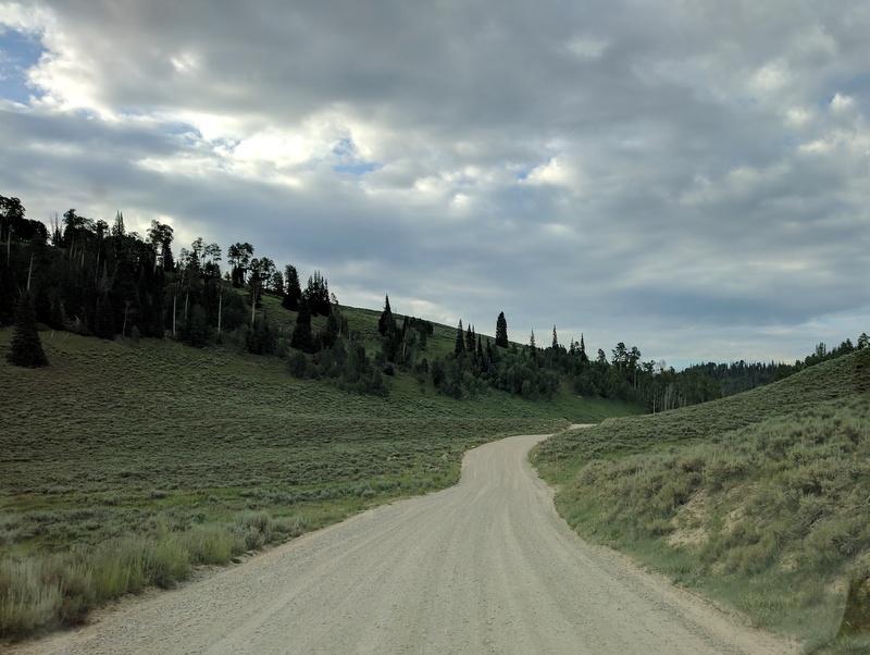
We found a camp spot within 1/2 mile of where the Miller Flat Road (FS0014) leaves Utah Highway 31 between Huntington and Cleveland Reservoirs. The gravel road south is very good, and we saw lots of large trailers and toy haulers along the way.

In spite of the country being well about 9,000 feet elevation, there are extensive wetlands, ponds, and reservoirs throughout the area.

Depending on the angle of the photo, Potters Pond was quite picturesque. Other angles showed how close last fall's forest fire came to the campground, burning right up to the edge of the pond.

The Potters Pond cache is only one of the caches in the area, but it's the one most sought because it is one of only three remaining caches that were placed in August, 2000.

We parked out of the way near campsites 18 and 19. These equestrian campsites are at the end of the road and there is no turn-around, so staying as far to one side as possible will help campers who need to turn around. This turn around is within a couple hundred feet of the Potters Pond 10 & 59 Year Birthday Bash cache which we used as a waypoint.

The first section of trail was very evident, passing through a meadow of wild flowers while paralleling the north side of a creek.

There's a large log across the creek downstream from where we crossed, but the creek was low enough that we decided to rock hop across the creek. Just across the creek is a letterbox hybrid cache, Potters 2 Present: Int'l Geocaching Day 2014! which became our second waypoint.

From the letterbox cache we headed south through a clearing where we saw some of the early signs of aspen windfalls that would become an integral part of the hike. The route through here was just a geotrail of bent grass but no bare tread. There were a couple barrels along the way that had clearly served as targets at some point.

There was a route that appeared to be an old overgrown logging road part of the way up the hill, with the route being very obvious until after we passed this larger windfall that was easier to go under instead of over.
From that point on, there seemed to be multiple routes, sometime with some bare tread, sometime with shorter vegetation. There were lots of windfall and sometimes it was easier to go around instead of over, but it was very clear that folks were finding lots of different ways to get there!

We'd been warned about the mosquitoes and had prepared accordingly so they weren't an issue as long as you kept moving. Once we got the cache open and started looking at the logbooks, the bugs started to descend so we didn't spent much time at the cache. We signed the log and

paused long enough to get a picture of me. I got a picture of BJ as well, but that picture gives away the location of the cache.

I started working on completing the Jasmer grid last summer as we traveled to the Northwest and then picked up three of the last four I needed when I volunteered in Jim & Sallee's office for a couple weeks last August. For nearly a year, I've had one last hole to fill and with this cache it's finally done.

A huge thanks to BJ for putting up with the significant detour on the way home and for joining me for this cache.

Friday, August 4, 2017

Oregon to Utah

Back to our regular programming...

We left Sutherlin early, heading up the North Umpqua River. It's one of those roads that doesn't show on most highway maps, and it's not fast, but it is beautiful. We've seen lots of columnar basalt in our Northwest travels, but this was the first time we've seen the 'ends' exposed. Very different!

We cut across the north side of Crater Lake National Park, looking for a spot to slip our drive from Oregon to the mountains east of Salt Lake into four more or less equal days. We wanted as much elevation as we could get for our first night since the temps were unseasonably warm. We ended up in a great spot less than an mile up FR3715 at the Quartz Mountain SnoPark on Highway 140.

The next morning we visited a cache less than 1/2 mile from our camp and then continued our our way south and east. We passed some folks along the way that I thought were geocaching. We stopped at the Oregon/Nevada border for a cache and they caught up to us. Not every day you run across other geocachers in the wild.

Thanks to geocaching, we tripped into a very interesting memorial park in Winnemucca. They had armament on display representing several major wars, but nothing newer than Viet Nam. Home for the night was the New Frontier RV Park in Winnemucca. Power for the A/C was a priority, and an adjacent restaurant eliminated the need to do dishes.

I'd really  wanted to boondock on the Salt Flats but the temps were too high so we ended up staying at the KOA in West Wendover. They know they're the only option and price it accordingly.

I didn't anticipate the WWII history in Wendover, Utah and West Wendover, Nevada. Apparently, the air base here played a key role in the preparation of the Enola Gay crew.

On the last day of our transit, we spent more than a couple hours crossing the Salt Flats. They say it's interesting at night as you can see the curvature of the earth made notable by watching the oncoming headlights rise out of the horizon.


While most of the flats were dry by early July, some areas were still flooded, making for some interesting reflections but nowhere to pull off to take pictures.

We finally got to where we were headed and found a site at the Lake Canyon Rec Area. With about 9500' elevation we were finally high enough that windows and fans were enough to keep the temps reasonable. It's boondocking but with designated sites and no services.